Crowded Space
Discover how Lloyd’s helps make space operations safer and more sustainable.
With global weather events coming thick and fast, rapid reactions to fire and flood have never been more of a challenge for the insurance industry. In major flood or fire events, the public may not have access to the area for days, or even weeks. This prevents insurers and reinsurers from understanding the loss, and most importantly of all, delays payments to those affected.
The management of the impacts of climate change can be much improved if communities and businesses have advance or real-time awareness of dangerous weather such as wildfire and flooding.
The next and most significant story to be told is how space can help us manage climate change.
Space monitoring has been seen as a possible answer for a decade at least. However, it is only now that a new generation of satellites, such as those operated by ICEYE, a recent graduate of the Lloyd’s Lab; are able to provide rapid fire, fully interpreted and frequent information about flood, fire and hurricane-hit areas. ICEYE’s meteorologists also constantly watch the weather and other factors which drive flooding in order to issue advance forecasts of where they expect flooding to happen – critical information for communities, businesses and their insurers.
By combining satellite imaging with multiple auxiliary information sources – including river/tidal gauge data, ground sensors, watershed maps, elevation models and open-source imagery – it is possible to deliver easily ingestible hazard data while a flood is still ongoing. This helps all those involved manage the impacts of climate change in real time.
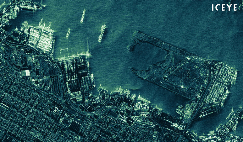
Radar image of the Port of Alexandria
The new constellation of SAR satellites also penetrate cloud cover or smoke and can produce reliable images in all weathers and at night – something which previous generations of satellite technology could not do.
For insurance companies and government bodies, this is unlocking the possibility of observing and reacting to ongoing floods as never before. Persistent monitoring of floods through the use of SAR satellites contributes to faster, fact-based event response and can enable automated claims notification, support the partial automation of claims handling, enhance customer service and facilitate rapid loss assessment and more accurate reserving. The depth of data provided can also go further, and support solutions to provide safety nets for communities at risk of flood.
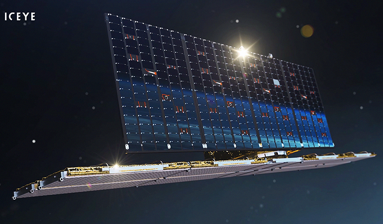
ICEYE SAR satellite
For example, ICEYE’s flood insights are powering a parametric insurance facility which has been put together jointly by the Insurance Development Forum (of which Lloyd’s is a member), and the United Nations Development Programme. Satellite data provided a simple trigger for payouts to be made, creating a grouped insurance product for vulnerable rural groups in Ghana, who now have financial protection in case of flood, whereas before they had nothing. This fills a protection gap, and also helps the local community adapt successfully to an increasingly extreme climate environment.
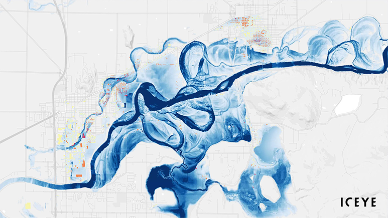
US – Canada border flood visualisation
Lloyd’s has seen the potential of ICEYE from the beginning, and following their time in the Lloyd’s Lab, have announced a partnership with ICEYE and McKenzie Intelligence Services (MIS), which will allow the whole market to have access to their flood hazard analysis solutions via the MIS Global Events Observer (GEO) platform. Overall, this type of data hugely speeds up the time to action, sometimes by a factor of weeks.
A number of Lloyd’s insurers are now taking advantage of this facility to develop innovative covers for vulnerable communities.
Although currently the market mainly uses satellites to monitor floods, the SAR constellation will soon also be used to track deforestation, and to monitor wildfires, building the range of climate change problems that can be managed through their system. It can also measure ice build-up and melting speed. Finally, the system can persistently monitor movement in the ground, tracking subsidence around, for example, dams and waste heads from open-cast mines. This data is accurate to within millimetres, and can be used to help predict risk of collapse in these high-impact environments.
Space technology is beginning to enable innovative activities within insurance and around the management of climate change, an innovation that enables better recovery from catastrophes than has even been thought possible.
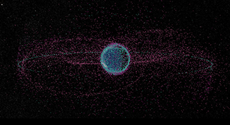
Travelling at 17,000mph in orbit, even the tiniest speck of space debris can chip windows and dent solar cells. Lloyd’s is working with data specialists (and Lloyd’s Lab alumnus) Privateer to track and monitor the movement of space debris.
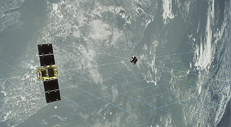
The Lloyd’s market is now providing risk mitigation solutions for the emerging ‘orbital economy’ - helping Astroscale’s new end-of-life satellite retrieval service to get off the ground.
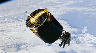
In 1984, Lloyd’s was the driving force behind the first-ever space salvage mission – mission STS 51 - working with NASA and the Discovery shuttle crew to bring two stray satellites back to Earth.
Discover how Lloyd’s helps make space operations safer and more sustainable.